top of page

Who Uses Maps?

Maps aren't just for travelers. Click below for some examples of environmental professionals that supply data for, create, or use some of the geographic mapping tools you see throughout this website.

Biologist researching in the forest.jpg
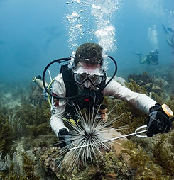
Marine Biologist studying black spiny sea urchins in Honduras.jpg
Close up picture of scientist geologist hands inspecting exploration on iron ore rock on o
Ecologist take water from source with tank with hand.jpg

Wildlife Biologist

Marine Biologist

Environmental Geologist

Hydrologist

Close up woman's hands in protective gloves. Scientist ecologist in the forest taking samp
Group of two scientists observing and tracking hurricane on map and analyzing weather. Ele
Cartography. A study of the terrain. Measurement work. Mapping. Geodetic equipment. The us
Scientist collecting a sediment core to asses carbon sequestration rates in the sediment o

Ecologist

Meteorologist

Cartographer

Conservation Scientist

Careers: Services
bottom of page